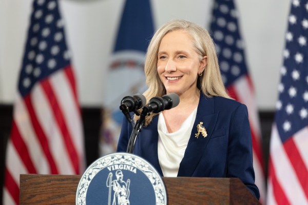
Virginia Gov. Abigail Spanberger delivers the Democratic response to U.S. President Donald Trump’s State of the Union address on February 24, 2026 in Williamsburg, Virginia. (Photo by Mike Kropf/Getty Images)
The directive calls for a statewide response plan and greater coordination among government agencies and technology companies as AI-related cyber risks grow.
WASHINGTON, DC – JULY 26: Participants gather as 60-Hour Medicaid Vigil Ends with Promise: “We Won’t Get Over This Betrayal – We’re Getting Organized” on July 26, 2025 in Washington, DC. (Photo by Tasos Katopodis/Getty Images for Caring Across Generations)
CANADA – 2026/10/16: In this photo illustration, the OpenAI logo is seen displayed on a smartphone screen with a green circuit board in the background. (Photo Illustration by Thomas Fuller/SOPA Images/LightRocket via Getty Images)
The legislation would direct a federal research lab to develop technology that helps first responders locate survivors in areas where traditional radio signals cannot reach.
U.S. Sen. Ed Markey speaks at the Massachusetts Democratic Party convention on May 30, 2026. (Photo by John Tlumacki/The Boston Globe via Getty Images)
The lawmakers argue cutting the federal broadband program would not address concerns about students’ screen time, pointing instead to existing internet-safety requirements and local device-use policies.
Oxnard, CA – October 05, 2026: Oxnard Shores photographed from an airplane on Monday, Oct. 5, 2026 in Oxnard, CA. Topographic LiDAR survey of the California coastline funded by the state of California monitors coastal erosion and morphology due to increasingly large storm and weather events along with rising sea levels. This survey serves as a baseline for future surveys and was conducted just before and after an active El Nino winter season.(Kayla Bartkowski / Los Angeles Times via Getty Images)
U.S. Sen Bernie Sanders (I-VT) and Rep. Alexandria Ocasio-Cortez (D-NY) hold a press conference to announce the Artificial Intelligence Data Center Moratorium Act at the US Capitol on March 25, 2026 in Washington, DC. (Photo by Tasos Katopodis/Getty Images)
Bry Pardoe, CIO of Pennsylvania, during the awards dinner of the 2026 NASCIO Annual Conference in San Diego on Sept. 29, 2023. (Julie Ellis, National Association of Chief Information Officers)
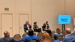
The IT Accessibility Panel at the 2026 NASCIO Annual Conference in San Diego, California on Sept. 28, 2026. Left to right: Kris Adams, chief accessibility officer for Pennsylvania; Marie Cohan, Texas statewide digital accessibility officer; and Kalea Young-Gibson, a senior policy analyst at NASCIO. (Scoop News Group)